


")


")


")
")
Western Ukraine
Lvov (Lviv) Region

 Lvov region's territory is 21.8 thousand sq. km. Population: 2,800,000 .The Lvov region is situated in the Western part of Ukraine and is one of its most developed region. In the north and northwest it borders upon Volyn and Rivne regions, in the west and southwest upon Ternopil and Ivano-Frankivsk regions, in the south upon Transcarpathian regions and in the west upon Poland. The region area makes 3.6 % of the territory of Ukraine. The main tourist destinations of the region are:
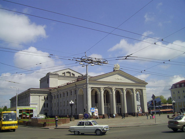
 Lvov (Lviv) - is an ancient Ukrainian city, one of the biggest cultural, economical and transport centers of Ukraine. The first mention about it dates back to 1256. The city is situated in the valley of the Poltva River, the tributary of the Bug. Lviv was founded by the Prince of Halych Danylo Romanovych who named the town in honour of his son Lev. In 1356 according to the norms of the Magdeburg Law Lvov was given the autonomy. The city of Lvov played a special role in the Ukrainian nation's history. It was a spiritual center for Ukrainians, their center of the social and political, economical, cultural and educational life. At the same time Lvov became the bright page in the history of Polish, Jewish, German, Armenian people. The city takes the first place in Ukraine by the number of historical and architectural monuments. It is distinguished for its unique beauty, monuments, and variety of architectural styles. The central part of Lvov is included in the UNESCO world heritage.
Other sights:
 Shevchenkivskyi Hai (the museum of folk-life and architecture) - This scansen represents an open-air museum of the Ukrainian wooden architecture and different utilities of the village life. It is situated in Shevchenkivskyi Hai (forest) - one of most picturesque sites of Lvov. More than 10 thousand of craft-items from various ethnographical regions of the Western Ukraine can be found in this museum. The visitors can feel the unique atmosphere of picturesque Ukrainian villages. The gems of this museum are the wooden churches from the Carpathian region - the most exquisite examples of Ukrainian wooden architecture.
Oleskiy Castle - It is a monument of the 14th -17th cc. architecture and contains a rich collection of paintings, sculpture and furniture from the 16th - 19thcc.
Zolochivsky Castle - construction reflecting typical European military architecture and has not had significant reconstruction for centuries. Built in 1630 like a citadel with bastions, it's surrounded by barrages.
Zhovkva town - There were private residencies of the crown hetman Stanislaw Zolkiewski and the King Jan the Third Sobieski, the military headquarter of Russian Tsar Peter the First, place of born and childhood of the Ukrainian Hetman Bohdan Khmelnitsky - establisher of Ukrainian State in XVII century. Zhovkva is the only example in Ukraine saved Renaissance "Ideal" city-citadel, the real pearl of national architecture heritage. Today on the small territory of the city, there are present two monuments of city house building, 55 architecture's monuments on world, national and regional level, two monuments of landscape architecture, 15 historical monuments.
To learn more about sights, excursions and tours in this region click here
Ivano-Frankovsk Region

 Lies in the northeastern part of the Ukrainian Carpathian Mountains, the Trans-carpathians and part of Opillya. The terrain is mountainous and hilly; part of the region's territory consists of flatlands. The highest ranges are the Gorgony (with a maximum elevation of 1836 m) and Chomohora (reaching 2061 m). The principal rivers are the Dnister, Prut, and Cheremosh. The climate is temperate-continental. Area: 13,900 sq. Km. Population: 1,458,000.
The harmonious fir-trees rise in the sky by green wall. The sweet-scented grass covers a mountain valley by colourful carpet. Wherever you glance over the forest greens everywhere, the Blue Mountains tower over, and between them the rapid rivers and streams discharge it pure waters to the Prut River and further to the wide reaches of the Dnister River.
The main tourist destinations of the region are:
 Ivano-Frankovsk (Ivano-Frankivsk)- is a royal free city that stretches between the Bystrytska Nadvirnianska and Bystrytska Solotvynska rivers in the foothills of the colorful Carpathians not far from the ancient Halych, the capital of the Halych-Volyn principality. In 1662 the city acquired the Magdeburg Law. It was established in the place of the village of Zabolottia as a fortress for protection from the raids of Crimean Tatars and as a base station of Polish magnates Potostky in the Halych land. Stanislaviv started from Market square and city hall, which have preserved for the present days but slightly modified. Design of the town outskirts, its streets, temples reflected the ideas of the Renaissance about the "ideal city".
Carpathian natural National park - A 503 square kilometer part of the mountainous territory is apportioned for the Carpathian natural national park. The main role of the Park is to assist in the preservation of the landscapes, vegetation and wildlife, thereby creating suitable conditions for rest and tourism while introducing tourists to the Region's natural resources and monuments of history and culture.
 Manyavsky Scyth - A monk named Jove Knyagunetsky who came from Greece's Athon fonded the monastery in 1612. That's why this place has been long called as Ukrainian Athon. But if you get to Monastery now, you'll find it difficult to imagine that this place in the middle of a deep forest used to be an influential religious and cultural center of the whole region.
 Kolomyya - Pysanka Museum - It is the only museum in the world, which was specially constructed for keeping and exhibiting the works of pysanka painting. Pysanka is a hen or goose egg painted using a special technology and covered with natural or aniline dyes. Pysanka is a work of miniature painting.
The National Reserve 'Davniy Halych' ('Ancient Halych') - This reserve was once home to an entire urban agglomeration and it was here where the capital of Galicia-Volyn principality was located. Archaeologists consider the Great Halych the largest city in the world of that time. In the 11 th-12th centuries it had a fortified territory of 8.5 km from the north to the south and 11 km from the west to the east. There is the Ancient Halych History and National Folk Architecture Museum.
Zakarpattya Region

 Zakarpattya is one of the most original corners of Ukraine. This is a region with the unique geopolitical and geographical location (covering the south-west part of the Ukrainian Carpathians and Dunabe lowland). Due to its geographical features Zakarpattya has been for long a convenient junction between the countries of Northern and Southern, Eastern and Western Europe. The territory of Zakarpattya Region is 12.8 thousand square km. By administrative-territorial division this is 13 districts, 10 cities including three cities of regional submission. The number of population of Zakarpattya is 1.2 million people.
The main tourist destinations are:
Uzhgorod - one of the ancient cities of Ukraine celebrating its 1100 anniversary. There are different versions regarding the origin of the city name. One of the them is connected with a city location above the Uzh River. The Uzhgorod has a very attractive and diversified architectural face. Despite the fact that castle, temples, administrative and dwelling buildings belong to the different epochs and architectural styles the city always looks like unique ensemble uniting the hoary antiquity and the presence. There you can see magnificent Uzhgorod castle (11-12th century built, Now you can find here the collections of the Zakarpatsky Museum of Regional Studies and Art Gallery), the museum of local lore of Zakarpattya (Its collection consists of more than 80,000 original historical objects. The present-day display acquaints the visitors with different periods in the history of the Transcarpathia. It includes natural, historical, religious, cultural and folk arts departments) and many other exciting places for sightseeing.
Mukachevo - It became the place of the fierce battles and during its history it was under the rule of different princes and kings. For a long time like the rest of Transcarpathia it was under the Hungarian and Austrian rule . One of the most interesting monuments of the past is the Castle that was originally founded as a monastery in 1393. It is located on the rocky mountain (68 m high) and towers over the town and neighbouring valleys.
To learn more about sights, excursions and tours in this region click here
Ternopol (Ternopi) Region

 The sources of history of Ternopol Region dates back to the distant times of Kyiv Rus and Galych-Volyn principality. For many centuries the people have been creating the eternal values for the motherland fruitfully preserved traditions, customers and national culture. The characteristic sign of nature of Ternopil land is its variety. The flat central part of the region's territory is surrounded by Kremenets sublimity in the north as well as on the west - Berezhansko-Monastyrsky (Podil) humpbacked mountain, on the east - Avratynska sublimity and on the south it is cut by deep and often canyon-like river valleys of left inflows of the Dniestr River. The central part of the region is crossed from the north-west to the south-east by the Tovtrova chine (Medobory). Its area is 13.8 thousand square km that makes 2.3% of the Ukrainian territories. The number of regional population is 1180.3 thousand people and it majority lives in the rural locality.
The region has Medobory reserve and three regional landscape parks; 14 national and 103 local sanctuaries are functioning; there are 11 national and 380 local natural sights, 4 tracts; 9 dendrology parks, 13 parks - sights of gardening art and three botanical gardens.
The original landscapes can be found on almost 30 percents of the region's territory. The natural complexes situated on the territories of natural reserves are the best-protected today.
The wonderful natural and recreation descriptions of Ternopol land, relatively favorable ecological situation, well-developed network of railways and highways in the region create good conditions for development of varied resort and sanatorium treatment and tourism.
The main tourist destinations of the region are:
 Ternopol (Ternopil) - city called "blooming capital of Podillia" is situated on the Seret River (the left tributary of the Dniestr river). It's attractive tourist destination. From the beginning Ternopol was a fortress for Podillia protection from Tatars attacks. The first mention about Ternopol as a property of crown Hetman Yan Tarnavskyi dates back to 1540. In the center of the city the ancient temple of the original architecture, the Christmas Church or as so-called Serednia, feast our eyes. It belongs to the most ancient building of Ternopol and is situated nearby the former city banks not far from the Kamianetska gate. Ivan Franko, Solomia Krushelnytska, Les Kurbas and other famous Ukrainian authors added a vivid page to the city chronicle.
Medobory Nature Preserve - national park of rocky bluffs along the high ridge overlooking the Podillyan steppe. The protected spots feature indigenous Ukrainian hardwood trees and forest flowers as well as springs and caverns. It is also the best place in Galicia to see wildlife and birds.
There are over 100 caves in the south of Ternopol region; Optimistic Cave is considered the longest in Europe with around 200km of gypsum tunnels. Krystalna and Ozerna are also very beautiful and individual caves.
Pochayiv Monastery - Ukraine's most sacred site, after the Pechersky Lavra in Kiev. Both monasteries started as secluded caves that evolved slowly into towering baroque edifices, and both monasteries greet hundred of thousands of Orthodox pilgrims each year. Pochayiv's collection of ancient master icons is revered by all Eastern Orthodoxy. The mount was first discovered by a group of refugee monks who had fled Kiev's Pechersky Lavra after the Mongol invasion in 1240.
Chernovtsy (Chernivtsi) region

 Chernovtsy Region is situated on the crossroads throughfares between the Central, Southern and Eastern Europe in the foot-hill of the Carpathian. It is one of the youngest regions of Ukraine.
The regional area is 8,1 thousand square km. The number of population is 922.8 thousand people (representatives of almost 80 nationalities and ethnic groups).
The main tourist destinations are:
Chernovtsi (Chernovtsy) is a city situated in the colorful foothills of the Caprathians, on the bank of the Prut River. Bukovyna is called the Carpathian beauty, land of beech forests, "eastern Switzerland". The unique wooden architecture, colorful mountain landscapes, combination of different cultures create the original image of the beautiful Bukovyna land. The first mention about Chernovtsy dates back to 1408.
 Bucovynian Carpathians - trip to Nimchich Pass will acquaint tourists with local customs and traditions, with nature and climate of this land. The tourists will admire its woodcarving displays, weaving, embroidery and metal inlaid work. Nimchich Pass hiking - what a place! It is real pleasure to go round picking up flowers, mushrooms and berries in the forest. Lunch at national Hutsul restaurant "Kolyba" ("hut") or "Hirska kazka" ("mountain fairytale ") will cheer you up!
Khotynska fortress - On the right bank of the Dniester, not far from a small town of Khotyn, which recently celebrated its 1000th anniversary, there towers the legendary Khotynska fortress. Khotyn's moment of glory was during the military campaign of 1621 when a 100-thousand Turkish army soldiers met the united troops of Poland and Ukrainian Cossacks near the walls of the fortress. According to the historians for eight days in a row, the Polish and the Ukrainians were united in celebrating their victory, which prevented Western Europe from enslavement. And now Khotyn is the best place to enjoy serenity and harmony. From a high rampart you can look at the green bank vaults of the blue Dniester, feel a fresh breeze or go down the narrow stone stair-steps to the gigantic basements where time stands still.
To learn more about sights, excursions and tours in this region click here
Lutsk region

 Lutsk region (Volyn) is the ancient Russian land that is stretched out in the basin of pictiresque south inflows of the Prypyat River and in the riverheads of the Western Buh River. The land, covered with the legends of ancient times, is glorified by monuments, which remind about the fight and bravery of our ancestors. This is a region of everlasting forests, groves and valleys, blue-eyed lakes, slow and rapid rivers. The region has a favourable geographical position, located in the north-western part of Ukraine within the zone of Ukrainian Polissya. The area of the region makes 20.2 thousand sq. m. The number of population makes 1053.5 thousand people.
Volyn is the territory of wonderful and unique nature. The Shatsk National Natural Park with the largest and deepest lake of Volyn Region - the Svityaz is the most value for recreation. The lake is of cavern origin and fed with mighty springs, so the water in it has curative abilities and it is rich in compounds of silver, bromine and glycerine. This corner of Volyn is named by the pearl of Ukrainian Polissya. The powerful recreation potential is characterized by the Ozeryanska group of lakes and lake of cavern origin, located in the basin of the Turiya River.
It is possible to familiarize with the rich historical and cultural inheritance of Volyn, visiting the Museum-Preserve "Cossack Graves", Memorial Complex in the village of Zaturka, created in honour of Vyacheslav Lypynsky, Museum-Farmstead of Prominent Poetess Lesya Ukrayinka in the village of Kolodyazhne, Historical-Regional Museum and Museum of Volyn Icon in Lutsk. The museum under the open sky in the village of Rokyni acquaints with development of agriculture and wood architecture in Volyn Region. More than 150 monuments of architecture are counted in the region. Among them there are the Zagorivskiy Monastery (XVI century), Lutsk Castle (XIV century), Assumption Cathedral in Volodymyr-Volynsky (XII century), Castle-Palace Complex (XVI-XVIII century) in the village of Olyka and many others.
Rovne (Rivne) region

 Rovno region situated on the Polissian plain and Volynian plateau and is densely intersected by many rivers. The largest of them is the Prypyat and its tributaries, the Horyn and Styr Rivers. This region has many lakes, especially in Polissia. The largest of them are Bile, Somyne, and Nobel. Forests occupy 38% of the territory. Area: 20.1 thousand sq. km. Population: 1,186,400 inhabitants.
 Rovno region is an owner of the great recreation -tourists resources. There are two state historical cultural reservations in Dubno and Ostrog towns with the monuments of history and architecture of the XIV-XIX centuries. There is the real state historical museum "The Field of Beresteyskaya Battle" in the village Plyasheva, there is going to be the festive celebration of 350 anniversary in memory of the heroes of the Beresteyskaya Battle in June, 2001. There are the monuments of history and architecture too the complex of Saint Troitskiy Convent, town Korets, on the territory of mentioned is the grave of Anna Andro, signed in the poems by Alexander Pushkin, the complex of Saint Nickolay Convent located in the village Gorodok of the Rovno district, the complex of Mezhyrichi Saint Troitsky Convent, located in Ostrog, Derman Convent, located in Zdolbuniv district. The excellent nature landscapes are in the Berezne district, so called "Sokolyni gory" ("Falcon mountains"), basalt columns of the Berestovets deposits in Kostopil district, amber deposits on the Northern districts of the region. There is very interesting to see the sights of the exotic kinds of trees dendro park of Berezne forest colleague, there is famous in Ukraine Yuzefinski Park with the 100-yars oak and the natural reservation "Vyshneva Gora" ("Cherries mountain"). The Saint Anna mystic spring with the curative water in the village Onyshivtsi, Dubno district is the place of Christians pilgrimage from all the parts of Ukraine & abroad. The great reacreation resources and the possible natural climate conditions has the zone, located around the Khrinniki water storehouse in Demidivka district. Rovno region is the owner of necessary natural and material technical basis for developing the extreme kinds of tourism; military, aviation, hunting, swimming by rafts, rest on the saddle.
Khmelnitskyi region

 Khmelnytsky Region is situated on the Right-Bank Ukraine, in the middle part of Volyn-Podil sublimity. It is the part of Ukrainian Podillya with its picturesque landscapes, fertile earths and hardworking people.
The territory of Khmelnytsky Region is 20.6 thousand square km. It is mainly forest-steppe, although the northern part of Khmelnytsky Region is the Polissya area. More than one million and four hundred thousand people live in the region. Khmelnytsky land has rich history, varied vegetable and animal world, and unique landscapes, rocks, caves, lakes and natural-raw potential.
The tourist resources of Khmelnytsky land are one of the powerful in Ukraine (after the Crimea and Carpathians). In the northern part of the region there is Polissya with its unique pine-woods. Exactly pine-woods and their ozone air did at one time the estate of grandees Sangushki in Slavutych region by the original Mecca for patients with tuberculosis. The elite of the Russian empire, Poland and Austria treated there. And the found supplies of radon waters enable to create creation of powerful resorts on their base.
Khmelnytsky Region has powerful recreation and balneology resources due to the presence of great number of sources of high-quality mineral water. The mineral water "Zbruchanska" (like as Truskavets "Naftusya") gave possibility to found resorts "Sataniv" and "Makiv" and the like. In fact the Zbruchansky deposit of mineral water is the biggest one in Europe. The people with the problems of digestion organs are making healthy here due to the use of this water as well as radio-active isotopes are brought out from the human organism.
There are almost 270 territories and objects of reserves in Khmelnytsky land. The National Natural Park "Podil Tovtry", where due to general efforts of many Podil inhabitants 60 species of plants, 80 kinds of insects, birds and animals were put to the Red Book of Ukraine, is the invaluable its treasure. On the territory of this park the "Atlantis", one of the most beautiful spouting horns is placed also.
 The history of Khmelnytsky land has a lot of glorious pages. One of the most interesting cities of not only Khmelnytsky region but also Ukraine and Europe is ancient Kamyanets-Podilsky city named by the pearl on stone. Its architecture saved the samples of cultures of many people, whose are living here: Ukrainians, Jewries and Armenians. And also there are many religions here such as orthodox, catholic, Judaic and moslem.
The center of world cultural inheritance UNESCO has registered the statement of Kamyanets-Podilsky city about inclusion of this Old city to the list of inheritance of world culture. Lately by joint efforts of local community and city authorities there was done much for the sake of creation of modern tourist infrastructure. Conducting of annual holidays and festivals assists in popularity of ancient Kamyanets as tourist center, in particular, Cossack Zabavy and International Festival of National Cultures. The tourists from the whole world will be interesting to visit also Trypillya settlement in Lutsa-Brublevska, Medzhubizhska fortress, ancient cities Izyaslav and Polonne. The Bakotsky rock monastery and grave of Hasidism founder Baal Shem Tova also attracts a lot of tourists.